
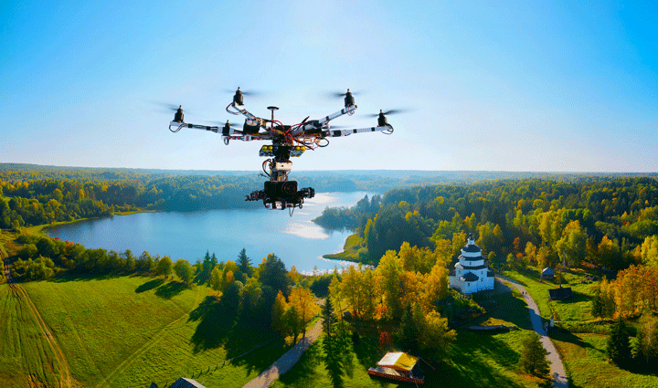
How Drone Photography Is Changing Real Estate
How Drone Photography Is Changing Real Estate
The real estate industry has always relied on visuals to attract buyers. Traditionally, high-quality photography and in-person property visits were the key marketing tools. But in recent years, drone photography has revolutionized the way properties are showcased, marketed, and even sold. From small residential apartments to sprawling commercial developments, drones are changing the game.
1. What Is Drone Photography in Real Estate?
Drone photography uses unmanned aerial vehicles (UAVs) equipped with cameras to capture high-resolution images and videos from unique angles and heights.
In real estate, drones are primarily used for:
- Aerial property photography
- 360° panoramic views
- Virtual tours and videos
- Land surveys and property inspections
These tools provide buyers and investors with a 360-degree understanding of the property before stepping foot on it.
2. Why Drone Photography Matters in Real Estate
✔ 2.1 Captures Property From Unique Perspectives
- Drones can capture bird’s-eye views of properties, showing the layout, landscaping, and surroundings in a way traditional photography cannot.
- For commercial and luxury real estate, aerial shots highlight size, amenities, and location advantages.
Example: A villa with a landscaped garden and swimming pool can be showcased in one panoramic aerial shot.
✔ 2.2 Saves Time and Costs
- Agents no longer need to schedule multiple on-site visits for prospective buyers.
- Buyers can virtually tour properties from anywhere in the world, saving travel time and costs.
- Developers can also use drones for project progress monitoring, avoiding manual inspections.
✔ 2.3 Improves Marketing Appeal
- Drone videos make property listings stand out online, attracting more clicks and inquiries.
- According to marketing studies, listings with drone photography can increase buyer engagement by 30–50%.
- Aerial footage is particularly effective for large residential complexes, plots, and commercial properties.
✔ 2.4 Highlights Surrounding Amenities
- Drones can capture nearby parks, schools, highways, shopping centers, and waterfronts, giving buyers a sense of location value.
- This perspective helps investors and buyers evaluate connectivity, neighborhood, and future growth potential.
✔ 2.5 Enhances Transparency and Trust
- Drone imagery reduces the risk of misrepresentation because buyers can see real, unedited property views from multiple angles.
- For luxury real estate, this builds credibility and helps justify pricing.
3. Applications of Drones in Real Estate
🏠 3.1 Residential Properties
- Small homes, villas, apartments, and gated communities benefit from dynamic aerial shots and virtual walkthroughs.
- Drones can highlight rooftop terraces, gardens, parking, and amenities.
🏢 3.2 Commercial Properties
- Office complexes, malls, and industrial units require large-scale shots to show overall layout.
- Investors can assess size, design, and surrounding infrastructure without visiting in person.
🌳 3.3 Land and Plots
- For vacant plots, drone surveys provide accurate measurements, boundaries, and topography.
- Helps builders, architects, and buyers plan construction and development efficiently.
🏗 3.4 Under-Construction Projects
- Drones can monitor construction progress remotely, provide weekly or monthly updates, and document milestones.
- Buyers and investors gain real-time insight into the project’s status, enhancing confidence.
4. Benefits of Drone Photography for Real Estate Agents
- Faster Property Sales – Better visuals generate higher engagement and quicker buyer decisions.
- Cost-Effective Marketing – One drone video can replace dozens of traditional photos and site visits.
- Improved Listing Visibility – Listings with drone footage tend to rank higher on real estate portals.
- Better Client Engagement – Virtual tours and aerial videos make presentations more immersive and interactive.
5. Challenges and Considerations
- Legal Regulations: Drone usage in India is regulated by the DGCA. Permits may be required for commercial use.
- Weather Dependency: Wind, rain, or low light can affect drone photography quality.
- Initial Investment: High-quality drones and cameras can be expensive, but ROI is often higher due to increased engagement and sales.
- Skill Requirement: Capturing professional-quality footage requires training and experience.
6. Future of Drone Photography in Real Estate
- 3D Mapping and Virtual Tours: Drones are being used to create interactive 3D models of properties.
- Integration with AI: AI-powered drones can highlight key features, detect defects, and optimize shots.
- Live Drone Streaming: Real-time virtual property tours are becoming possible for international investors.
- Augmented Reality (AR) Integration: Buyers may soon explore properties through AR-enhanced drone footage for immersive experiences.
✅ Conclusion
Drone photography is no longer just a luxury; it’s becoming a necessity in real estate marketing. It enhances property visibility, builds trust, saves time, and offers unmatched perspective to buyers, investors, and developers.
For real estate professionals and property developers looking to stay competitive in 2025, embracing drones can dramatically improve sales, marketing, and project management.

